Almost Home: Superblooms and Grit
- randyjoss
- Jun 8, 2023
- 15 min read

Ok, we'll admit it. We're ready to be done. 27,000 miles is a LONG way and we are both pretty pooped.
Yet . . . This was the perfect part of the country to end in. Not only was it spring in the desert (always beautiful), but in a year of record rains, we got to see the "Superbloom" in action almost everywhere we went. The juxtaposition of harsh, rocky, "gritty" desert landscape against the explosions of greens, reds, yellows, purples and oranges was truly incredible. We were very very lucky and it made a fitting bookend to the New England fall colors that we began the journey with back in September.
We have to admit though, between the desert in Spring and New England in the fall, we couldn't pick a favorite. They were equally spectacular. And given how close it is, we both agreed that we definitely need to take Doris back to the desert.
This was a long stretch of visits. Since New Mexico, we've been to:
Lake Roosevelt, AZ - Saguaro cacti forests surrounded by orange, purple, and yellow blooms
Cottonwood & Sedona, AZ - We spent about 5 days in the red rock hills and canyons. It's really lovely, but oh so very touristy. The Disneyland of hiking.
Petrified Forest National Park, AZ - Lots of trees that used to be under water.
Canyon De Chelly National Monument, AZ - A vast park (a "mini grand canyon") on Navajo tribal lands in NW Arizona. Our Navajo guide, Richard, was a highlight, but the more we learned about Native American history and present-day demographics, the more disturbed we got.
Valley of the Gods, Southern Utah - A dirt road in the middle of nowhere, we found this camping spot by accident on a facebook group and it turned out to be one of the highlights of the whole trip. Part of the Bears Ears National Monument.
Vermillion Cliffs National Monument, AZ - Some great hiking in the slot canyons and a truly fantastic camping spot. Part of the Grand Staircase - Escalante National Monument.
Lake Roosevelt, AZ
The whole reason we ended up in this relatively unknown spot is because Randy can't read a calendar. We were HOPING to get to Phoenix in time to catch the Giants last spring training game. Unfortunately, that mean that Randy was planning to watch baseball on a Sunday, but the last game was actually on a Saturday! So suddenly we were in the middle of Arizona realizing that the ONLY way we could get to the game was to hunker down and drive 6-7 straight hours.
Sadly, that's really not how we roll on this trip. We don't hurry.
So, we looked on the map to see if there was a body of water anywhere between us and Sedona that might be interesting. It turns out that Lake Roosevelt was on our way westward and also had 3 different federal campsites. (Side Note: we LOVE federal campsites. Aside from being clean and level and well-run, we get 50% off with Joan's lifetime senior national park pass . . . You NEED to get one of these as soon as you turn 62)
Well, we got incredibly lucky, or maybe EVERYWHERE in Arizona is beautiful this time of year, but the Lake Roosevelt area was spectacular! (And, oddly, GREEN.) The saguaros were amazing, like giant people watching from all angles. The closest thing I've ever see to this kind of feeling is the Joshua Trees in that national park. Additionally we counted at least 5 other amazing types of cactus as well as 8-10 different species of flowers that were blooming. Under an incredible, bluer-than-blue sky with giant cottonball clouds it was yet another spectacular hike in the Southwest (remember how incredible New Mexico was?)
Oh, and we had to chuckle at the billboard we saw as we crossed the border into Arizona. :-)

"The Sedona Area", (but really we stayed in Cottonwood . . . which we liked better.)
SIDE NOTE: Before we start on Sedona, the topic of the Pie Bar has to come up. There is literally NO reason we could see why people would otherwise visit Strawberry, AZ. There seems to be a scattering of vacation cabins but we couldn't really tell why. Yet, there was this giant Salvador Dali head on the sign and I couldn't resist pulling over. They have the most amazing selection of astoundingly delicious empanadas (both savory and sweet) that everyone needs to FIND a reason to visit. Randy had four.
Now, about Sedona. There are just way WAY too many people there. There are shuttle buses to the trailheads because they've run out of parking. The traffic is bananas -- I mean there are traffic jams a mile long if you go the wrong way at the wrong time. Ok, the food is good and the hiking is pretty spectacular, but just don't stay IN Sedona.
Yes, go hiking in Sedona. It is definitely wonderful. Layered red cliffs, rocky spires, and lush, forested canyons. It really is pretty. It's just as crowded as the bathrooms at a Warriors playoff game. I guess it's a "must do" tourist spot, but clambering up a slope with 50 other intrepid hikers feels just a touch "Disney". Maybe we've been spoiled with all the other places we've stumbled on?
Sedona is a beautiful, crowded place. . . kind of like Marin County.
Where you need to stay is in Cottonwood. The town is cute, fun, and, most importantly, calm. It actually FEELS like a small town. We stayed at the state park there -- which has great running trails btw -- and really enjoyed it. A must visit in Cottonwood is the winery at Caduceus Cellars. I'm told the wine is quite good, but we mostly got a kick out of the fact that the winemaker is the lead singer of a metal band called Tool. His first wine label was called "Merkin Vineyards". (Feel free to look up the definition of Merkin on the Interweb. It's not your usual vineyard name, that's for sure!). The combination of great wine, good food, and head-banging music seems like an "Only in Arizona" sort of moment. Oh, and yes, you can buy Tool's albums at the winery.
Had to get a kick out of that last sign. It was on an uncrowded trail we found outside the old mining town of Jerome, AZ (As far as we know it WASN'T named after Joan's brother Jerry). Clearly the guy using the sign as target practice had some anger issues about the trail restrictions! Another classic Arizona moment.
Petrified Forest National Park
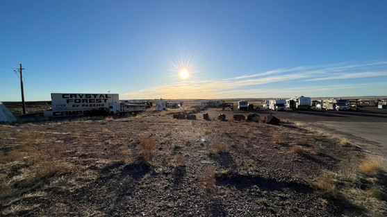
On our way to Canyon De Chelly, we decided to stop at the PFNP for a look. We stayed in the Gift Shop parking lot just outside the gate to the park. It was free and the landscape was gorgeous at sunset and sunrise. PFNP is basically a drive-through park. One main road with a handful of fun sites showcasing the petrified wood that's lying on the ground pretty much every where you turn. This area used to be all water and the minerals in the sediment seeped into fallen trees and "turned them" to stone.
Along the way we also learned what "badlands" are -- soft sedimentary rocks that have been extensively eroded and where no vegetation can grow. Basically they look like giant piles of mud drippings. Those are great examples in the last 3 pictures. Between the frozen in stone logs and the giant piles of plant-free mud, it really feels like another world!
Canyon De Chelly, AZ -- The Navajo Nation
To go into the canyon you have to hire a Navajo guide. Our guide was Richard and while the canyon history he provided was fascinating, his personal history was even more compelling. Richard grew up as one of 8 children (6 of whom have since left the reservation, which is a pretty typical fraction for most Navajo families). Richard's mother was taken from her family as a young girl, by the US government. Her parents gave up both girls to the government while hiding 9 boys at home.
The government's Indian Policy at the time was to forcibly relocate and educate Indian youth (with or without their parents' consent) to help assimilate them into US culture. One headmaster of a school described his goal as education that would "Kill the Indian in him and save the man". So Richard's mother was relocated to Riverside, CA, and educated/socialized into white culture. There she learned to read, write, and speak english and she went on to become a nurse. For a woman growing up in the 1950's, that was quite an accomplishment and I can understand how people in a different era might have thought of that as progress and maybe even a "social good".
Although we can understand how people of the time might have characterized their Indian policy as "progress", it's hard to gloss over the fact that the US government has lied, cheated, and stolen from every Native American tribe repeatedly over the past 350 years. It herded those that it could coerce away from their native lands and onto a handful of reservations up and down the plains. Those it couldn't coerce, it killed. And that was explicit government policy -- relocation or extermination. So when it comes to the tradeoff of eradication of Indian culture in return for job training and economic gain I suppose, if you squint, that it's possible to have seen that as a relative good against the backdrop of horror.
PS. . . . there's a recent book out, Empire of the Summer Moon, about the fall of the last bands of Comanche Indians to submit to government control. It was a finalist for a Pulitzer and was a terrific read if you're interested. It's an eye opener both with respect to the US Government's actions, but also with respect to the Comanche culture and their brutal domination of the Southern Plains. Having traveled through Comanche territory, we found it even more amazing how they thrived in that never ending sea of grass.
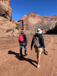
The Canyon (pronounced "Canyon De Shay") is sacred Navajo land and the Navajo have lived here for over 300 years. Even before that, there have been bands of pueblo indians in this canyon for perhaps 5000 years. It's a spectacular landscape -- wide river bed running along a broad, flat canyon floor. Ideal for farming, shelter, or defense. Today, cottonwood groves and farms dot the river for most of its 35 miles.
Richard was a terrific guide who loved to tell stories, but he admitted that he found it difficult to talk and walk at the same time. As a result, we didn't travel as far as we'd hoped, but we had a good time doing it.
Bears Ears National Monument, Utah -- Valley of the Gods
In yet another fortunate twist of fate, as we played with the map and scratched our heads about where to go next, we stumbled on a review of a place called The Valley of the Gods. It's more famous cousin is Monument Valley -- they're about 40 miles apart -- but VOTG is much less travelled.
This turned out to be one of the most memorable places of the entire year. We turned right off the highway onto a dirt road. There were little pullouts off the dirt road every 1/2 mile or so for camping and a scattering of RV's and trucks were there to spend the night. Other than those 20 or so cars spread out across the 17 mile road we pretty much had the valley to ourselves. I got to go for a run. Joan had a nap. And we watch the sun set over something called Battleship rock. The sky was IMMENSE, the stars were bright, and the boulders perched on the cliffs above us did indeed look like Greek Gods watching over us. I mean, no, there's nothing to do there but stare at the valley, yet that, plus dinner and a beer, was about as perfect an evening as I've ever had.

Bears Ears National Monument, Utah --The Citadel
Leaving the Valley of the Gods, we had no reason to expect what our day had in store for us. As it turned out, Utah and Bears Ears had quite a day planned for us. First though, was the drive out of the valley.
Looking back on it, well, we SHOULD have been terrified . . . driving an 8,000 pound van that catches the wind like a schooner on a 1.5 lane dirt road with no guard rail, 20 mph gusts, and a 1000 foot drop-off. I mean, what part of that sounds safe?? Yet, Joan (as usual) drove it with grace and style and a few well-timed hoots and hollers. And after a while we came to the NEXT dirt road, the one that would lead us to our hike out to the Citadel.
Check out that first picture. This road was also super sketchy, soft dirt with the occasional snow drift (yes, snow drift) and some rock piles that looked like they were straight out of a Range Rover ad. . . . Yet Doris was again a stellar performer (this time Randy was driving, but Doris still pulled thru!).
Although the trail would have led us out along that land bridge to what I'm sure would have been some fabulous vistas from the Citadel rock formation itself, You'll see from the video why we decided against walking out onto the land bridge that day. The weather app said the wind was blowing 35-45mph! I was reminded of the time El Gray and I bailed out of a walk across the ridge at Castle Peak in similar conditions . . . and I'm happy to say that both times we chose discretion over possible wind blown, gory death.
Leaving the Citadel though, our wanderlust got the better of us and we chose to head north into Utah rather than back down the road of death into the Valley of the Gods.
The further north we got into Utah, the less hospitable the conditions became. Although the scenery was initially spectacular.

We were soon overtaken by a sandstorm. A full-on, can't-see-50-feet sandstorm. Even now, 3 months later, we still have some of that sand in the van. There was simply NO WAY to keep it out. . . On the bright side, it helped us understand even better just how amazing it was that the dust bowl pioneers stuck it out for almost 10 years!

Although we found a nice, free place to park off the side of the road for the night, a day of hiking at Capitol Reef National Park was not in the cards. We awoke to temps of 22degrees and a WIND CHILL OF -7 degrees. . . . yes, MINUS SEVEN!
That last little shack is the birthplace of Butch Cassidy. It turns out he was the first of THIRTEEN children, born just out the little town of Beaver, Utah. It was a majestic, amazing spot, but living there in the 1860's would have been a VERY hard life.
Grand Staircase-Escalante National Monument, Utah -- Wirepass Canyon
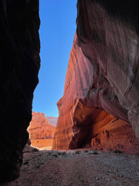
Given the wind & snow we headed south QUICKLY, for the town of Kanab and the Grand Staircase-Escalante National Monument. In the southern part of the park are a series of magnificent slot canyons made famous in recent years by virtue of the fact that one particular feature, called The Wave, became famous as one of the pre-packaged backgrounds in Microsoft Windows. Although we didn't get a permit to go see the wave itself, we got to explore plenty.
We again found a dirt road. This time about 8 miles long and leading us to the trailhead at Wirepass Canyon. We parked there overnight -- again, all by ourselves with just stars, sky, and desert for companionship -- and then headed out hiking in the morning. It took a little bit of convincing to get Randy going in the morning though. There was this VERY ominous sign about flash floods and on-going rescue efforts and "proceed at your own risk" . . . yadda yadda yadda (you can read it in the first pic). Joan was POSITIVE everything was going to be fine though. And, of course it was. It was a spectacular day and our longest hike of the trip, close to 10 miles.
In defense of my trepidation about flash floods, I have to point out the ladder we found. In the last picture above, you can see the place where the nice Forest Service personnel had left this 8-9 foot ladder that would have allowed us an easy way over this rock. However, the ladder wasn't where it should have been. Instead, because of the recent floods, we found the ladder a half mile "downstream" and about 30 feet up the wall of the canyon. This is where the waters had washed it down and it had gotten stuck! Getting stuck in a flood like that would have been no joke!

Las Vegas, NV and A little Time at Home
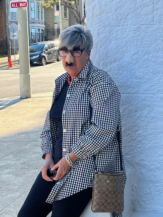
From Grand Staircase, we did a drive through at Zion National Park -- lovely, but also very very crowded! -- before stopping in Las Vegas. In Vegas, we went to Top Golf and found a truck wash. We got Doris all cleaned up before heading home to surprise Glen on his 60th. (If we look a little odd, it's because went in disguise. :-)
Thought for the Day - Poverty, Policy, and Parenting
I have to circle back to the Navajo nation here because Joan & I spent so much time talking about it.
To set the stage, here are a few facts about the town of Chinle, a Navajo town just outside of Canyon De Chelly.
Population of 3,900, recently declining by 12% ANNUALLY
The average household income is $44,000 which sounds comparable to other towns we've seen (like Clarksdale, MS)
However, the average household in Chinle is 5 people vs just 3 people in each household in Clarksdale. . . . Meaning the income per person is just 60% of what it is in Clarksdale.
In Clarksdale 49% of the population are below the poverty level. In Chinle, that number is 86% of the population.
The average age of a resident in Chinle is just 23 years old (vs 35 in Clarksdale). This is possibly because the kids are all leaving town around the time they hit their 20's. Or perhaps healthcare outcomes are way worse on the reservation. We don't know, but the population graph we found (here) was the most unusual we've ever seen.

After having been through Oklahoma and the First American's Museum, and after reading about US Indian policy it was hard for us not to look at the conditions in Chinle and feel like we, as a country, should do better here. Yet, we had a super interesting conversation with a couple nice conservatives who felt that the Indians hadn't done enough with what they had -- that they needed to build more businesses and work harder in school.
We certainly don't know enough to comment intelligently on what opportunities have been given or squandered, but we were struck by the philosophy because we'd heard it a number of times before on the trip. It's the idea that there are some folks who have pulled themselves up from poverty by sheer force of will (and often a really strong mother). Clarence Thomas and J.D. Vance are two examples that come to mind. And the idea is that because they did it then everyone should be able to if they just tried hard enough. The obvious extension of this idea is that any poor people who don't advance out of poverty just aren't trying hard enough.
As Joan & I drove and reflected on this conversation there were two questions we kept coming back to. First was the important role that a strong parent can play -- true for both Vance and Thomas, but also for our guide Richard. Does that mean that kids without strong, capable parents are doomed regardless of how talented they are? Without someone to love them and help build their character, buttress their determination, and aim higher than they believe possible are these young people consigned to a life of whatever status quo they're born into?
Secondly, for young people born in to poverty we seem to be saying that advancement can only come as the result of uncommon talent, character, and determination. This is bedrock stuff in American society. The hard worker, bootstrapping himself (usually a him) slowly but inexorably into financial and social success. It's hard to deny that it's the kind of life that produces admirable citizens, the kind we like to think of as the foundation of American culture. Yet, if that life of hard won success is so important to us, why don't we require it of those who are born into wealth? Two jobs, night school, having a "side hustle". As my grandfather Alex would have said, these are the things that "Build Character" (he would have added that cleaning the basement this afternoon would help as well :-).
Both of us are always struck by how much social policy questions are often similar to parenting problems. What do we value in life and how do we teach that to our children? How much hard work is enough? How do you know when to ask for help, and how much help is enough? When is support good for you and when does it just make you more dependent on getting help??
Questions like those have no simple answers. We find with our own family that the answers even change depending on the child and the situation. Some kids want to do it all on their own and need most to learn how to ask for and accept support. Others wilt in the face of difficulty and need to learn to believe in themselves before they can start to work. The result is that we parents end up changing our approach on a daily basis as we do our best to balance discipline with encouragement, and temper challenge with support . . . all while somehow communicating that unconditional love for the person is SEPARATE from this desire to build and develop their character.
Isn't this what we as a society most want for all of our citizens? For them to know that they are loved while at the same time growing in their ability to contribute to the community? We couldn't imagine what sort of public policy this would imply. However, as with kids, it's probably different for different people.
Our conversation ended on this thought: "Do you suppose we could ask our wealthiest children to work as hard for their success as we're asking our poorest to work? Or, similarly, shouldn't we give as much support and love to our poorest children as our wealthiest children receive?"
Yes. I think. How? No idea.














Comments